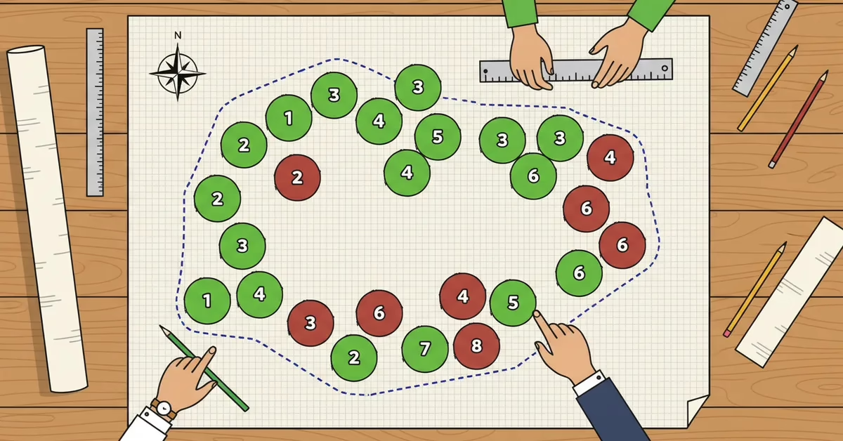
A tree preservation plan is the drawing and report that shows every regulated tree on a development site, which trees will be removed, which will stay and how the keepers will be protected during construction. In Lake and McHenry counties, a tree preservation plan is often a condition of a subdivision, site plan, building permit or demolition permit, and the rules change at every county and village line. Five rules come up again and again:
- Lake County: on wooded development sites in unincorporated areas, survey every tree 12 inches DBH or larger.
- McHenry County: in conservation-design subdivisions, map and tag desirable native trees from 4 inches and all other trees from 8 inches.
- Libertyville: the tree survey must be signed and sealed by a Certified Arborist.
- Algonquin: replace removed trees at 2 inches for every inch lost, with oaks and hickories replaced in kind.
- Every code here: fence the critical root zone or drip line before equipment arrives.
A3 Environmental Consultants (A3E) prepares tree surveys with an ISA Certified Arborist and delivers them alongside its wetland and ecological permitting work. This guide walks through each rule and what a reviewer expects to see.
What a Tree Preservation Plan Is
A tree preservation plan has two parts. The first is a tree survey: a tagged inventory of every tree above the local size threshold, with species, diameter at breast height (DBH, measured 4.5 feet above grade), condition and location. The second is the plan itself: a site drawing that marks each tree as removed or preserved, shows where protection fencing goes and adds up the replacement trees or fees the removals will cost.
Codes use different names for the same thing. Algonquin asks for a Tree Preservation Plan. Northbrook, on the North Shore, asks for a tree protection plan. Some reviewers ask for an arborist report, which is the written findings that explain the survey data: which trees are healthy, which are hazards and which can survive construction with care. The names change, but the reviewer wants the same answers.
When you need one
The trigger is almost always development. The Village of Libertyville Tree Preservation Code applies to subdivisions and planned unit developments, any building or demolition permit, and special use or site plan reviews. Algonquin ties its survey and Tree Preservation Plan to building permits and development approvals. McHenry County’s tree protection rules apply to conservation-design subdivisions. If your project touches any of those approvals, start the tree preservation plan before the site plan is final, not after.
Lake County: the 12-Inch Rule
In unincorporated Lake County, when a development site has woodlands or significant trees (deciduous trees 24 inches DBH or larger and evergreens 12 inches or larger), the Unified Development Ordinance’s Natural Resource Protection section (§ 151.071) calls for a survey of every tree 12 inches DBH or larger, including trees on property lines and in hedgerows. For each tree, the survey records location, size, species and health on a 5-point scale. The survey can be prepared by a certified arborist, a professional forester or a registered professional in a related field, and when a reforestation plan is required, it must be prepared by a certified arborist or a registered landscape architect.
The county’s Woodland Specialist field-checks the submittal, so the tags, sizes and species on paper have to match the trees on the ground (see the county’s Woodland Analysis page). That is why a tree preservation plan in Lake County starts with careful field work: a missed or mislabeled tree is easy for a field reviewer to spot.
A3E saw this rule in practice on a Libertyville tree survey for Ahead Engineering LLC. Lake County’s reviewer on this project required a certified arborist on site, and the survey counted every non-invasive tree 12 inches DBH or larger. Working with Davey Resource Group, whose arborist led the inventory, the team tagged 143 trees in one field day. Nineteen measured 30 inches DBH or more, and the largest was 58 inches.
Remember that the county rule covers unincorporated land. Inside a village, the village code applies, and it can be stricter, as the Libertyville section below shows.
McHenry County: Tagged Inventories for Conservation Subdivisions
McHenry County‘s Unified Development Ordinance puts its tree protection rules in the conservation-design subdivision chapter. Under § 16.76.030, the chapter applies to subdivisions of more than five lots that also meet a natural resource trigger. When it applies, § 16.76.090(H) requires a scaled drawing of every desirable native tree 4 inches DBH or larger and every other tree 8 inches DBH or larger.
Each tree on that drawing carries:
- A tag number
- Common and scientific name
- DBH
- Condition
- Any problems noted in the field
The tree preservation proposal and any tree replacement plan must be prepared by a qualified arborist, forester or similarly qualified professional. During construction, the code calls for fencing and signs around the critical root zone, no grading or material storage inside it, and boring for utilities that pass near protected trees.
Replacement is steep for large trees. Under the county’s replacement table (Table 16.76-3), removing a tree 26 inches DBH or larger calls for 12 to 15 new trees, and the county may approve a fee in lieu. A tree preservation plan that saves even a few big trees can change the replacement bill a great deal.
A3E’s Woods Creek project in Algonquin shows what a McHenry County inventory looks like in the field. Every tree 6 inches DBH or larger in the survey area was tagged, sized, rated for health and located by Trimble GPS: 225 trees in four field days.

Tag number, species, DBH and condition go into the data table for every tree.
Village Rules That Go Further: Libertyville and Algonquin
Villages write their own tree codes, and two of them show how far the rules can go.
Libertyville
Libertyville‘s Tree Preservation Code (Chapter 9 of the Village Code, last amended in 2019) protects canopy trees in three groups: Group A from 6 inches DBH, Group B from 8 inches and Group C from 10 inches, with smaller thresholds for understory trees and all evergreens 8 feet tall or more. The code states that “the tree survey shall be signed and sealed by a Certified Arborist,” and the village’s demolition checklist asks for a “tree survey signed by certified arborist.”
The development survey must be prepared “by a licensed surveyor in concert with a licensed arborist.” A3E has not found an Illinois arborist license, so ask the village which credential it accepts before the survey starts.
Protection means fencing at the drip line, or 6 inches of mulch topped with two layers of 3/4-inch plywood. Removed trees are replaced at 3 trees for Group A, 2 for Group B and 1 for Group C, or the developer pays a $350 fee in lieu per tree.
Algonquin
The Village of Algonquin’s tree protection rules (Chapter 5, § 5.15, and the Chapter 21 zoning code) set out each step:
- A permit is needed to remove any tree 10 inches DBH or larger, and a survey is needed to remove more than four trees.
- A building permit needs a survey of trees 4 inches and larger at a scale of 1 inch to 30 feet, a Tree Preservation Plan and, if the Village Arborist asks for one, a report from a certified arborist.
- For development, the tree preservation plan is prepared by a qualified arborist, forester or similarly qualified natural resources professional, and the survey lists each tree’s tag number, common and scientific names, DBH, condition and any observed problems.
- Critical root zones must be fenced, and neighbors’ trees within 10 feet of the work must be protected too.
- Replacement runs 2 inches for every inch of DBH removed (0.5 to 1 for weedy species). Oaks and hickories must be replaced with native oaks and hickories. The fee in lieu is $100 per caliper inch.
The in-kind rule matters on oak sites. A tree preservation plan that keeps a healthy oak avoids both the replacement inches and the search for native oak or hickory stock to plant.
What a Certified Arborist Puts in the Plan
A tree preservation plan is only as good as the field data under it. On A3E projects, the plan is built from these pieces:
- Tags and GPS. Each tree gets a numbered aluminum tag and a sub-meter GPS location, so the drawing, the data table and the trees in the field all match.
- Species. Common and scientific names, which drive rules such as Algonquin’s in-kind oak and hickory replacement.
- DBH. Measured 4.5 feet above grade, with cumulative DBH for multi-stem trees. Libertyville had 25 multi-stem trees out of 143.
- Condition. A rating on a 1 to 6 scale with a written note behind every score. A tree can rate poor for missing bark even when its crown is healthy, and the note tells the reviewer why.
- Risk. A clear split between trees that have to come down now and trees that can be monitored, with priority on dead limbs over houses, streets and schools.
- Invasive species. Buckthorn and other invasives are flagged, since codes often treat them differently. Algonquin’s replacement ratio drops for weedy species, and the Libertyville survey counted only non-invasive species.
- Fate and protection. Each tree marked remove or preserve, with fencing drawn at the critical root zone or drip line.
The deliverables are a tree data table, a GPS shapefile the engineer can drop into the site plan, and a summary of findings letter. That letter is the arborist report many reviewers ask for. It explains the ratings, names the trees at risk and recommends which ones to save.
A3E’s arborist, Thomas Casey, earned ISA certification in 2026 and brings a background in municipal forestry with the City of Milwaukee. Because A3E also handles wetland delineation and permitting, the tree data and the permit package come from the same team.
Every condition rating gets a written note that explains it.
Protecting the Critical Root Zone During Construction
The critical root zone is the area of soil around a tree that holds the roots it needs to survive. Most tree damage on a construction site happens there, out of sight, when equipment compacts the soil or a trench cuts the roots.
Codes measure the zone in different ways. Kane County’s June 2024 draft tree protection chapter, which A3E has not confirmed was adopted, uses 1 foot of radius for every inch of DBH. Libertyville fences at the drip line. Whatever the formula, the tree preservation plan should draw the zone on the site plan so every contractor sees it.
Fencing at the root zone keeps equipment and soil piles away from the roots.
Here is what the McHenry County, Algonquin and Libertyville rules ask for during construction:
- Fence before work starts. McHenry County calls for fencing and signs at the critical root zone. Algonquin requires root zone fencing and protection of neighbors’ trees within 10 feet. Libertyville requires drip-line fencing or the mulch and plywood alternative.
- Keep everything out of the zone. McHenry County bars grading and material storage inside it.
- Bore, don’t trench. McHenry County calls for boring for utilities near protected trees.
On A3E sites, the arborist adds a few field practices: keep equipment outside the drip line, manage soil compaction, use vertical mulching to relieve compacted soil, and monitor a stressed tree instead of removing it when it can recover. A3E’s arborist does not work near power lines, which requires a separate line-clearance certification, but can direct a line crew on where to cut.
A case from A3E’s arborist’s field experience shows why this matters. A mature, healthy shade tree next to new construction was nearly cut down after equipment compacted its root zone. The right call was to protect it, mulch and monitor. A certified arborist on the job saves the tree, the schedule and the argument. Writing that call into the tree preservation plan, or the tree protection plan your town asks for, puts it in front of every contractor.
Frequently Asked Questions
Who can prepare a tree preservation plan in Lake or McHenry County?
It depends on the code. McHenry County and Algonquin accept a qualified arborist, forester or similarly qualified professional. Libertyville requires the tree survey to be signed and sealed by a Certified Arborist. A3E’s plans are prepared by an ISA Certified Arborist.
What is a critical root zone?
It is the soil area around a tree that holds the roots the tree needs to survive. Kane County’s 2024 draft code sizes it at 1 foot of radius per inch of DBH, while Libertyville fences at the drip line. Construction fencing keeps equipment and soil out of it.
What is the difference between a tree preservation plan and an arborist report?
The tree preservation plan is the drawing that marks each tree to be removed or preserved and shows the protection fencing. The arborist report is the written findings behind it, explaining tree condition, risk and which trees can survive construction.
How much is a fee in lieu of replacement trees?
It varies by town. Libertyville charges $350 per tree not replaced. Algonquin charges $100 per caliper inch. McHenry County may approve a fee in lieu under its conservation subdivision rules. Every tree the plan saves is a replacement you do not owe.
A3E project fingerprint
- Projects: Libertyville Tree Survey; Woods Creek Force Main Replacement
- Cities: Libertyville, Illinois; Algonquin, Illinois
- Counties: Lake County; McHenry County
- Coordinates: Libertyville: [coordinates needed]; Algonquin: [coordinates needed]
- Staff: Thomas Casey, ISA Certified Arborist; Colleen Stull, Senior Project Manager
Need a tree preservation plan in Lake or McHenry County? A3E puts an ISA Certified Arborist on your site and delivers the plan with the wetland, habitat and ecological services work it often travels with, including endangered species surveys. Request a quote or call us at (888) 405-1742.

We Fix Gnarly Environmental Problems
Reviewed by Thomas Casey, ISA Certified Arborist
