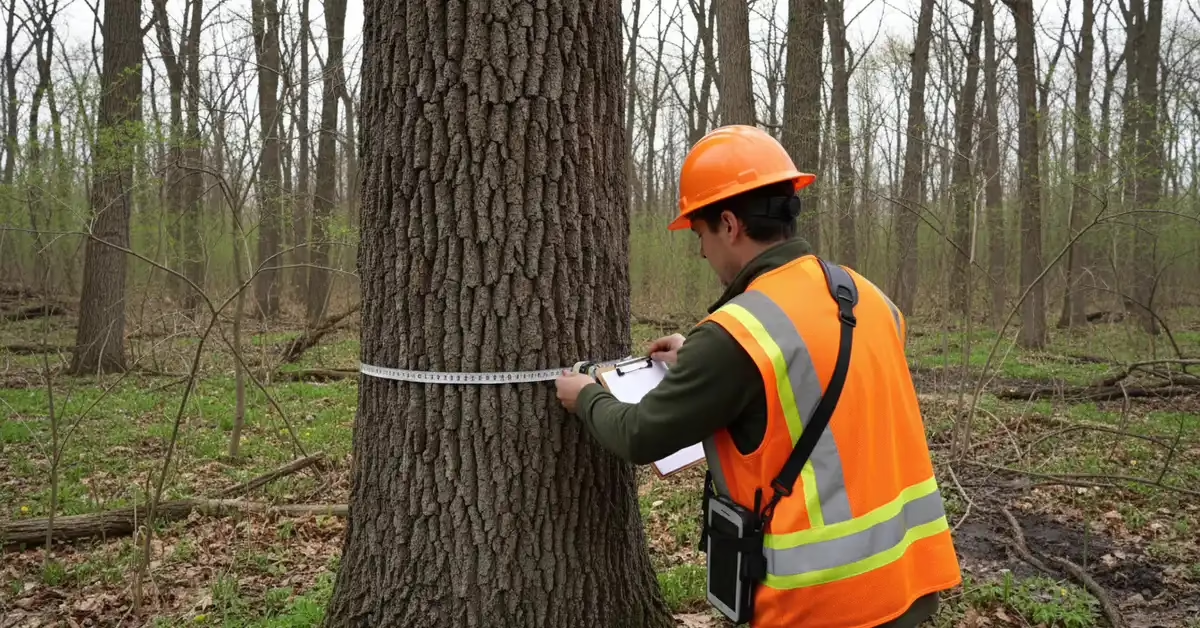
A tree survey is a tagged, measured record of every regulated tree on a site, listing species, trunk diameter, condition and GPS location, so a permit reviewer and a design team can decide which trees stay and which come down. In 2026, A3 Environmental Consultants (A3E) completed two of them in two Chicagoland counties under two different rule sets. In Libertyville, Lake County, A3E teamed with Davey Resource Group to inventory 143 trees in one field day for Ahead Engineering LLC. In Algonquin, McHenry County, A3E tagged 225 trees in four field days as part of a wetland delineation and permitting job for Trotter and Associates, Inc. That is 368 trees across five field days, every one tagged, GPS-located and condition-rated. This profile explains how each job worked and what your team can expect.
Why a Tree Survey Comes Before the Permit
Many Chicagoland counties and villages tie their tree rules to grading, building and demolition approvals. Before they sign off, they want a fixed baseline: how many trees, how big, what species and what condition. Every later decision about removal, replacement and protection gets measured against that count.
The rules are local, and they change at the county line. In unincorporated Lake County, when a development site has woodlands or significant trees, the Unified Development Ordinance (§ 151.071) calls for a survey of every tree 12 inches in diameter at breast height (DBH) or larger, recording location, size, species and health (see the county’s Woodland Analysis guidance). At Woods Creek in McHenry County, the survey counted every tree down to 6 inches. A survey done to the wrong threshold means a second trip to the field.
How A3E Ran the Libertyville Tree Survey
Ahead Engineering LLC needed a tree inventory at 31132 to 31140 N. Milwaukee Avenue in Libertyville. Lake County’s reviewer on this project required a certified arborist on site. A3E teamed with Davey Resource Group (DRG): DRG Inventory Arborist Pete Sorensen, an ISA Certified Arborist who is TRAQ qualified, led the inventory on March 18, 2026, with support from A3E’s field arborist. A3E delivered the summary of findings on March 25, 2026, one week after the field day.
The survey counted every non-invasive tree 12 inches DBH or larger. That matches the 12-inch tree survey threshold in Lake County’s development code, which also leaves box elder, mulberry and other weedy species out of its protection rules. The crew tagged and rated 143 trees, giving Ahead Engineering a complete record to measure against that standard:
- 19 trees at 30 inches DBH or more, the largest at 58 inches
- A median diameter of 18 inches
- 25 multi-stem trees, measured by cumulative DBH
- Top species: boxelder (58), Norway maple (35), black cherry (19) and mulberry (12)
Field notes flagged girdling roots, trunk wounds, powerline pruning and one tree leaning into another. The package included A3E’s summary letter, DRG’s letter and the full data table.
Woods Creek: a Tree Survey Inside a Wetland Job
The Woods Creek Force Main Replacement along Algonquin Road shows tree work as one piece of a larger permit. For Trotter and Associates, Inc., A3E’s scope, proposed in February 2026, paired an aquatic resource delineation to U.S. Army Corps of Engineers (USACE) Chicago District standards with floristic quality, habitat and high-quality aquatic resource (HQAR) assessments, plus a Joint Permit Application to USACE, the Illinois Department of Natural Resources and the Illinois EPA.
The tree work covered a localized part of the site. Every tree 6 inches DBH or larger was tagged, sized, rated for health and located with a Trimble GPS unit. A3E delivered a tree table PDF and a GPS shapefile that fit the same mapping as the wetland delineation and permitting work. The project was completed July 31, 2026: 225 trees tagged in four field days.
Project Snapshot
| Libertyville | Woods Creek, Algonquin | |
|---|---|---|
| Client | Ahead Engineering LLC | Trotter and Associates, Inc. |
| County | Lake County | McHenry County |
| Size cutoff | Non-invasive trees 12 inches DBH and up | All trees 6 inches DBH and up |
| Trees | 143 | 225 |
| Field days | 1 (March 18, 2026) | 4 (completed July 31, 2026) |
| Condition | 22 good, 69 fair, 43 poor, 3 critical, 6 dead | Rated tree by tree in the tree table |
| Deliverables | A3E and DRG letters, full data table | Tree table PDF, GPS shapefile |
| Context | Stand-alone inventory, DRG leading | Wetland delineation and joint permit application |
A3E project fingerprint
- Projects: Libertyville Tree Survey; Woods Creek Force Main Replacement
- Cities: Libertyville, Illinois; Algonquin, Illinois
- Counties: Lake County; McHenry County
- Coordinates: Libertyville: [coordinates needed]; Algonquin: [coordinates needed]
- Staff: Thomas Casey, ISA Certified Arborist; Colleen Stull, Senior Project Manager
What to Expect From a Tree Survey
A3E follows one field method, so the data holds up when a reviewer checks it:
- A numbered aluminum tag on each tree, matched to a sub-meter GPS location.
- Species by common and scientific name.
- DBH measured 4.5 feet above grade, with cumulative DBH for multi-stem trees.
- Condition on a 1 to 6 scale, with a note explaining each rating. A tree can rate poor for missing bark even when its crown looks healthy.
- Risk notes that separate trees that have to come down now from trees that can be monitored, with priority on dead limbs over houses, streets and schools.
- Deliverables: a tree data table, a GPS shapefile and a summary of findings letter.

Each tree gets a numbered tag and a sub-meter GPS point.
A3E delivers this work alongside its ecological services, including wetland delineation and endangered species surveys, so the tree data and the permit package come from the same team.
Frequently Asked Questions
What is a tree survey?
A tree survey is a field inventory of the trees on a site. Each tree is tagged, identified, measured for DBH, rated for condition and located by GPS. Counties and villages use it to decide which trees can be removed, which must be protected and how many replacements are owed.
Is a tree inventory the same as a tree survey?
The terms overlap. In A3E’s work, the tree inventory is the data table of every tagged tree, and the survey is the whole job: field work, GPS map, inventory and summary of findings letter.
Who can prepare a tree survey for a permit?
It depends on the code. On the Libertyville inventory, Lake County’s reviewer required a certified arborist on site. For development, the Village of Algonquin’s tree protection code asks for a tree survey plus a tree preservation plan prepared by a qualified arborist, forester or similarly qualified natural resources professional. Check the local ordinance before you hire.
How long does it take?
It depends on tree count and terrain. Libertyville covered 143 trees in one field day, with the summary delivered a week later. Woods Creek took four field days for 225 trees on a wetland site.
Need a Tree Survey in Chicagoland?
A3E puts an ISA Certified Arborist on your site and delivers the tree survey with the wetland, habitat and permit work it often travels with. Request a quote or call us at (888) 405-1742. Planning a wetland delineation on the same site? Start with our guide to wetland delineation cost.

We Fix Gnarly Environmental Problems
Reviewed by Thomas Casey, ISA Certified Arborist
