A desktop analysis will be conducted to identify any known or potential wetlands located at the site in relation to the planned site development locations. This analysis will determine the floodplain boundaries, hydric soils, topography, wetlands on the National Wetlands Inventory, signs of aquatic resources on aerial imagery considering rainfall conditions of the dates analyzed, and specific regulatory requirements for aquatic resource delineations for the site.
As a disclaimer, please note that the desktop analysis report is not an official aquatic resource delineation, and it will not confirm wetland or waterway presence, locations, or boundaries on the property or within the buffer. It is designed to assist the client in determining general site suitability prior to conducting an aquatic resource delineation.
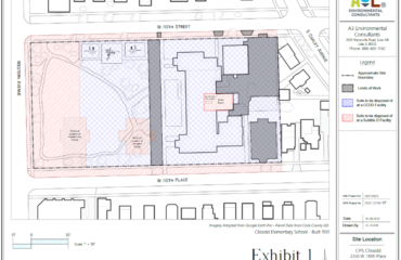
A map of the area(s) to be reviewed is attached to this proposal. In the event of any map discrepancies, the client should notify A3E at their earliest convenience.
TURNAROUND
Below is the associated turnaround time and price for this project.
- Duration – 20 Business Days
Client is responsible for understanding the entirety of this proposal including all incorporated and referenced documents as well as the applicable industry standards to which the work is performed. By clicking the checkbox on the payment screen, the Client confirms that they have read and accepted A3E’s Standard Terms & Conditions.
Additionally, because of the fast turnaround on this project, the Client acknowledges that in the event the project is canceled for whatever reason, A3E will issue a refund minus time and materials already incurred by A3E. (e.g. “from time of acceptance to time of cancellation”).
Scope of Work: Wetland Screen Download PDF here.

We Fix Gnarly Environmental Problems


